My first entry in this series detailed how Tolkien’s Middle-Earth, when correctly scaled, perfectly matches the landscape of Ice-Age Europe. Tolkien’s placement of mythic locations such as Mirkwood also matches their attested locations in ancient Europe.
My theory is that J.R.R. Tolkien meant for his Middle-Earth legendarium to be a literal mythology of ancient Europe. While the professor made vague allusions to his mythology being a telling of our ancient past, I believe he took this more seriously than he ever publicly admitted. I do not believe he meant it only as a frame story.
I strongly recommend reading (or rereading) the first post before continuing on:
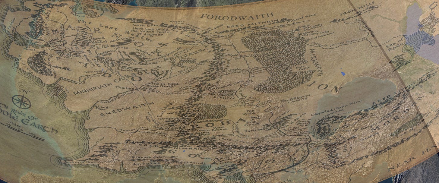
Keep in mind that when I talk about my map projection of Middle-Earth onto Europe, I am consistently referring to the map projection from the first article, not picking and choosing different scales to make things work.
Today, I want to expand by going into deeper detail on more locations within Tolkien’s mythology and their real-world counterparts.
I also want to examine some of the issues with the map from my first post. I will examine the issue of the Black Sea, and also explain why I believe the south of Middle-Earth looks so unlike the real Mediterranean.
Let’s get started.
Doggerland and the Kingdom of Arnor
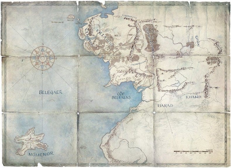
The Northwest region of Middle-Earth is what initially inspired this series. Specifically, it was when I first saw a map of Ice Age Europe and recognized the shape of the Ice Bay of Forochel and the coastline of Eriador.
In the first post I went over most of the locations from The Lord of the Rings, but I only briefly mentioned the lost European landmass called Doggerland and how it corresponds to Tolkien’s northern realms of Arnor and the Shire. Since then, I’ve found even stronger connections between the two.
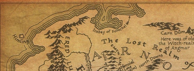
Tolkien’s “Lost Realm of Arnor”, the only populated region of Eriador, is the lost land of Doggerland.
A brief overview:
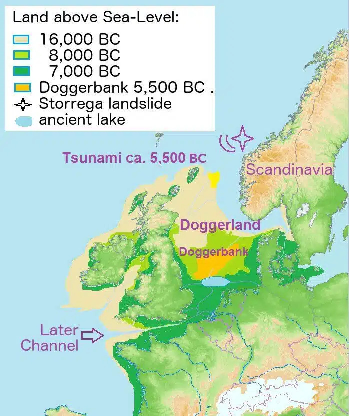
This landmass in Northwestern Europe once connected the British Isles to the mainland, and over time it sank, in stages, into the ocean. The last part of Doggerland to remain was what is now known as Doggerbank, and it lasted as an island until around 5500 BC. It was this part of Doggerland that contained the Dogger Hills, and on its southern border was the large ancient lake now called the Silver Pit Lake.
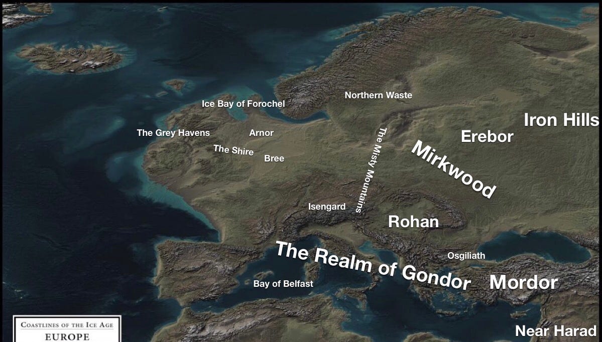
If you look again at the map projection from the first post, you’ll see that the Dogger Hills and the Silver Pit Lake (now in the North Sea) happen to line up right near Tolkien’s Hills of Evendium and Lake Nenuial.
This is just another coincidence that seems to prove that Tolkien was aware of the landscape of Doggerland and ancient Europe. Tolkien’s map contains very few lakes, in fact it is sparsely detailed. I do not believe it is a coincidence that this little-mentioned, but large lake in Tolkien’s map corresponds to what was the largest lake in ancient Northwest Europe.
It makes sense that Tolkien chose this location for the seat of power of his Northern Kingdom, Arnor. Both major cities in Arnor are located in this area of Doggerland, one of them on the shores of the ancient lake. Since recorded civilization did not begin in Northwest Europe until long after the time period that Tolkien set LOTR in, it makes sense to place the civilized region of Eriador on a location that would disappear before our recorded history began. The lost Northern realm of the sea kings, the Shire, Bree, etc, are all in Doggerland in this map projection.
The countries of Northwest Europe that exist today, like France, Germany, Britain, and Ireland are left unpopulated by humans on Tolkien’s map. They are home only to mythic races like elves and dwarves.
I believe Tolkien did this to have a personal explanation for why there is no longer any record of an ancient civilization in Northwest Europe- it is now under the North Sea, and any human civilization would have been lost. Of course, he never spoke on this, but the geography of the Dogger Hills and the Silver lake undeniably match his own map.
In regards to the Shire, it is interesting that the realm of the Hobbits also falls in Doggerland, not England as might be assumed. The part of Doggerland that contains the Shire is just to the East of Southern England. This also makes senses, as there is of course no realm of Hobbits in modern England. Tolkien wrote that this race of little people eventually faded and dwindled into a rustic woodland folk- this makes even more sense if he believed that their homeland had been cataclysmically flooded, and they were forced to flee to Britain as refugees.
The Black Sea and the Brown Lands
The Black Sea at first appears to be wholly absent from Tolkien’s Middle-Earth, even with my own map projection. I will admit that while writing the first post, I thought this was a hole in my theory.
But now I believe differently.
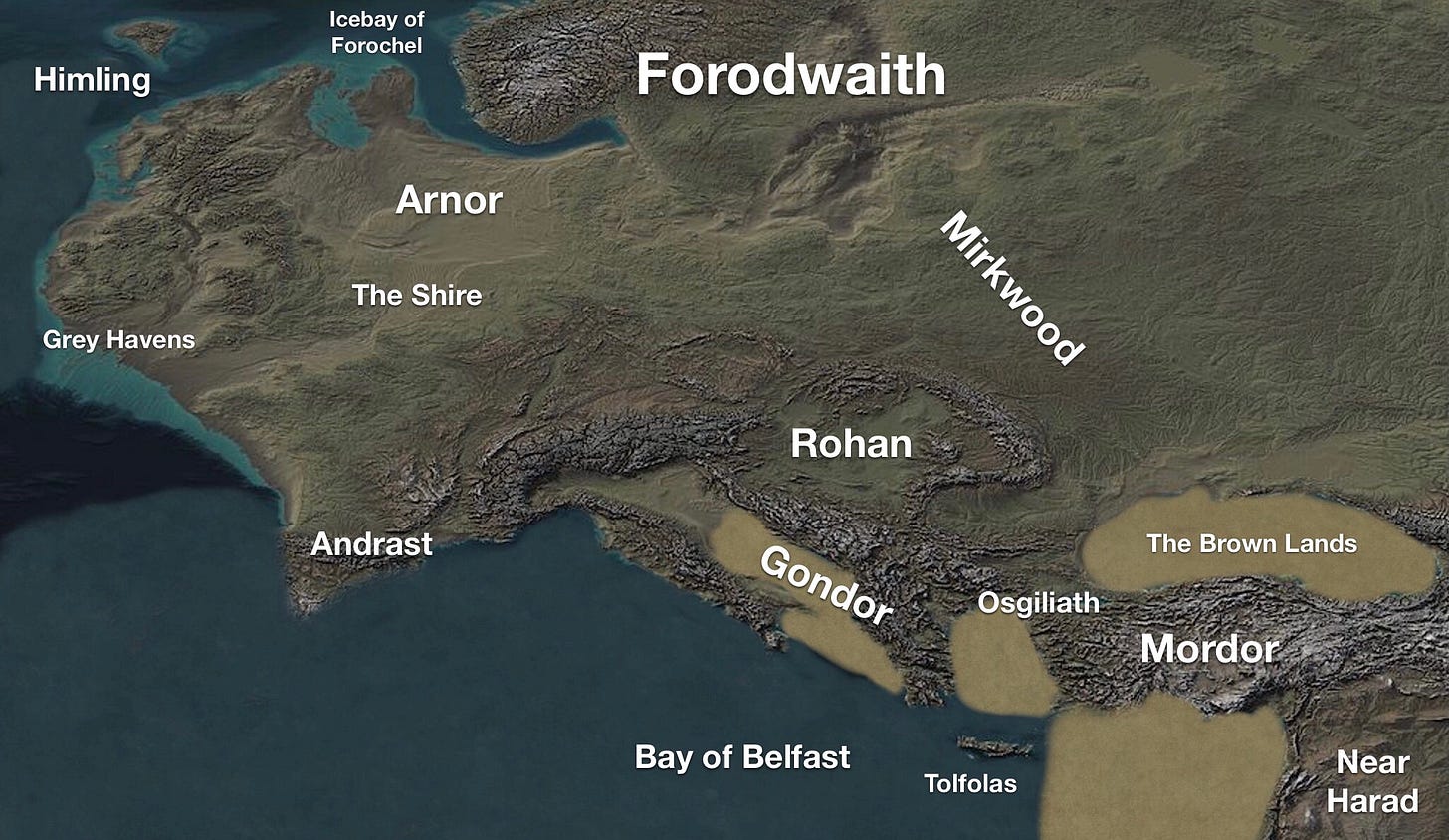
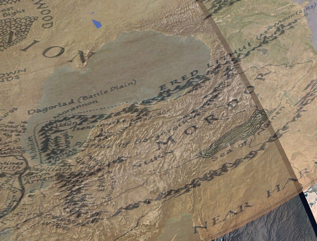
On my map projection the Black Sea falls on Tolkien’s “Brown Lands” and the Dagorlad Battle Plain, a desolate land north of Mordor that has been turned into an barren desert by Sauron. It does not seem a likely location for a lake.
But what if Tolkien hinted that it would later become one?
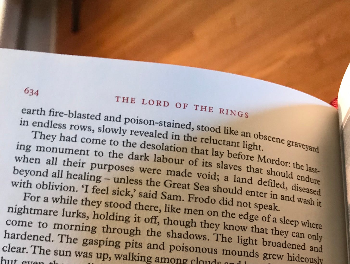
As I was rereading the Lord of the Rings, looking for more material for this series, I came across this. I had been looking for something that connected the Brown lands to the Black Sea, and I found this short hint. Tolkien writes this as Frodo and Sam approach Mordor from the north:
“They had come to the desolation that lay before Mordor: the lasting monument to the dark labour of its slaves that should endure when all their purposes were made void; a land defiled, diseased beyond all healing – unless the Great Sea should enter in and wash it with oblivion.”
If you are familiar with reading Tolkien, you’ll known that whenever he writes a hypothetical like this, when he writes that “unless” something were to happen, he is telling us that that something is going to happen. He uses the hypothetical voice as a literary device, since the frame story of LOTR is that these stories were recorded by the Hobbits.
But Tolkien knew more than Frodo, and he is telling us that the great sea would sweep into the Brown Lands and wash away the evil of Sauron.
Well, we know that the Black Sea was not always connected to the Mediterranean. And it just so happens that the scientific theory in regards to the Black Sea is that it was violently flooded during the Holocene, the period that LOTR would have been set in. You can read about it here.
Now, in real life, it was already a smaller lake that was flooded and became bigger. But we can forgive Tolkien this - the Black Sea deluge hypothesis was not published until 1997.
Tolkien suggested this idea well before the scientists. I think this small paragraph from LOTR proves that Tolkien meant for the Brown lands to become the Black Sea.
So not only does this score a point for the theory that Middle-Earth really is ancient Europe, it scores a point for my own map projection being correct. Nowhere else in Europe would fit here.
Rather than being a hole in the theory, the Black Sea is exactly where it should be, as the remnant of the waters that washed away the evils of Sauron, ages ago.
Númenor and the Mid-Atlantic Ridge
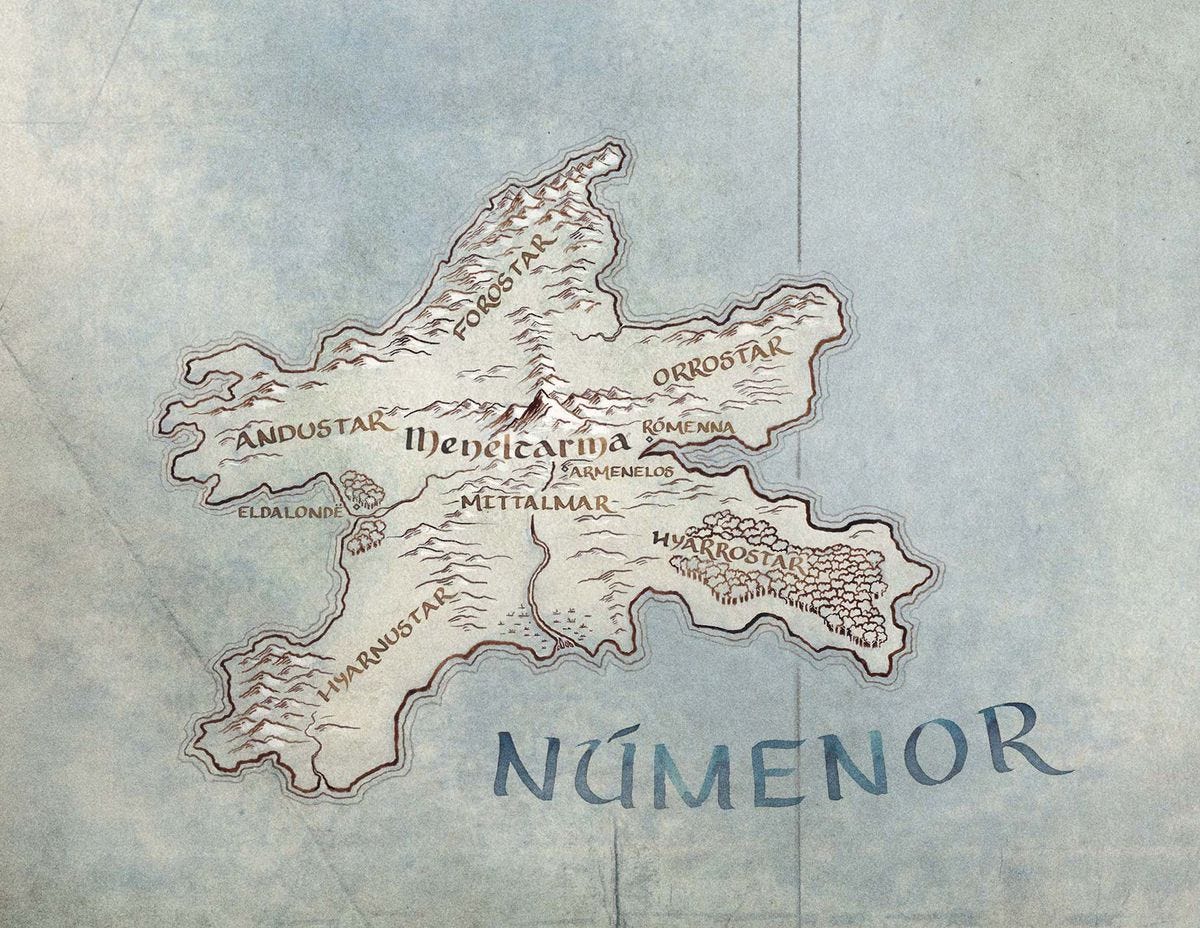
Let’s turn away from Middle-Earth and journey to the island kingdom of Numenor, Tolkien’s Atlantis. You can read more about that connection in this piece I wrote recently, but this connection is no secret. In fact, the Atlantis connection to Númenor was discussed in great detail by the professor himself.
But what its notable here is that his Númenor lines up directly on one of the most popular suggested locations for the real-world Atlantis- the Mid-Atlantic Ridge.

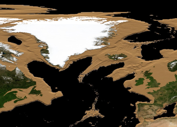
You may have seen pictures like the one above before, usually in theories about the location lost city of Atlantis. The Atlantic Ocean is one of the most commonly suggested locations of the lost city, and specifically the Mid-Atlantic ridge, and it is possible Tolkien subscribed to this theory. However, despite Númenor’s mythic and literary similarities to Atlantis, the star shaped island does not appear to resemble any real place.
It certainly doesn't look anything like the Mid-Atlantic ridge, or so I thought until recently.
I was playing around with this video, and I came across something interesting.
This is what the Mid-Atlantic ridge would have looked like at a higher sea level:

Now, I can’t prove that Tolkien did this intentionally, and I’m not sure if in his time he even could have had access to this information. And maybe some will disagree that there is any real connection here. But perhaps he knew the general shape of the Mid-Atlantic ridge, and perhaps he privately subscribed to the theory that this was Atlantis’ location. Either way this is an interesting coincidence.
Beleriand and the Helcaraxë
Now we’ll move on even further into the past.
Beleriand was the land to the Northwest of Middle-Earth, which by the time of The Lord of the Rings had sunk under the ocean.
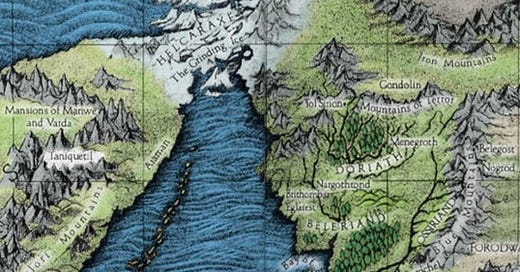
The Helcaraxë was a land bridge in the ancient days of Middle-Earth that connected the Western continent to the Eastern one in the icy North of the world.
I want to point out that in our world, with sea levels at the level where the Mid-Atlantic ridge/Númenor appears, both of theses features also reappear.
There is a great landmass to the West of Middle-Earth that covers Iceland, and a land bridge through what is now Greenland connecting the continents in the North. There is also more land in the far North above Europe near the pole, covering the modern day mountainous island of Svalbard, where Morgoth’s dark kingdom of Angband as well as the elven mountain city of Gondolin would have been located in Tolkien’s mythos.
These landmasses existed long ago.
Did Tolkien know about this as well? Was he familiar with all the ways our world has changed over the ages? I think he was, and he wrote the stories of those times.
Another small note proving this point, Tolkien would have known the Pangea theory, of when in far ancient times all the continents of the Earth were one. Tolkien includes this era in his mythology. Before the dawn of humanity or even the elves in his mythos, the gods dwelt on an unbroken, circular Middle-Earth surrounded by ocean.
It seems that Tolkien had all of this in mind, and included it all in his own mythology of our ancient past.
What about the Mediterranean?
Now it’s time to address the big issue with my theory and my map projection. If everything lines up so well between Middle-Earth and ancient Europe, then what’s going on in the Mediterranean? (Iberian bros are mad)
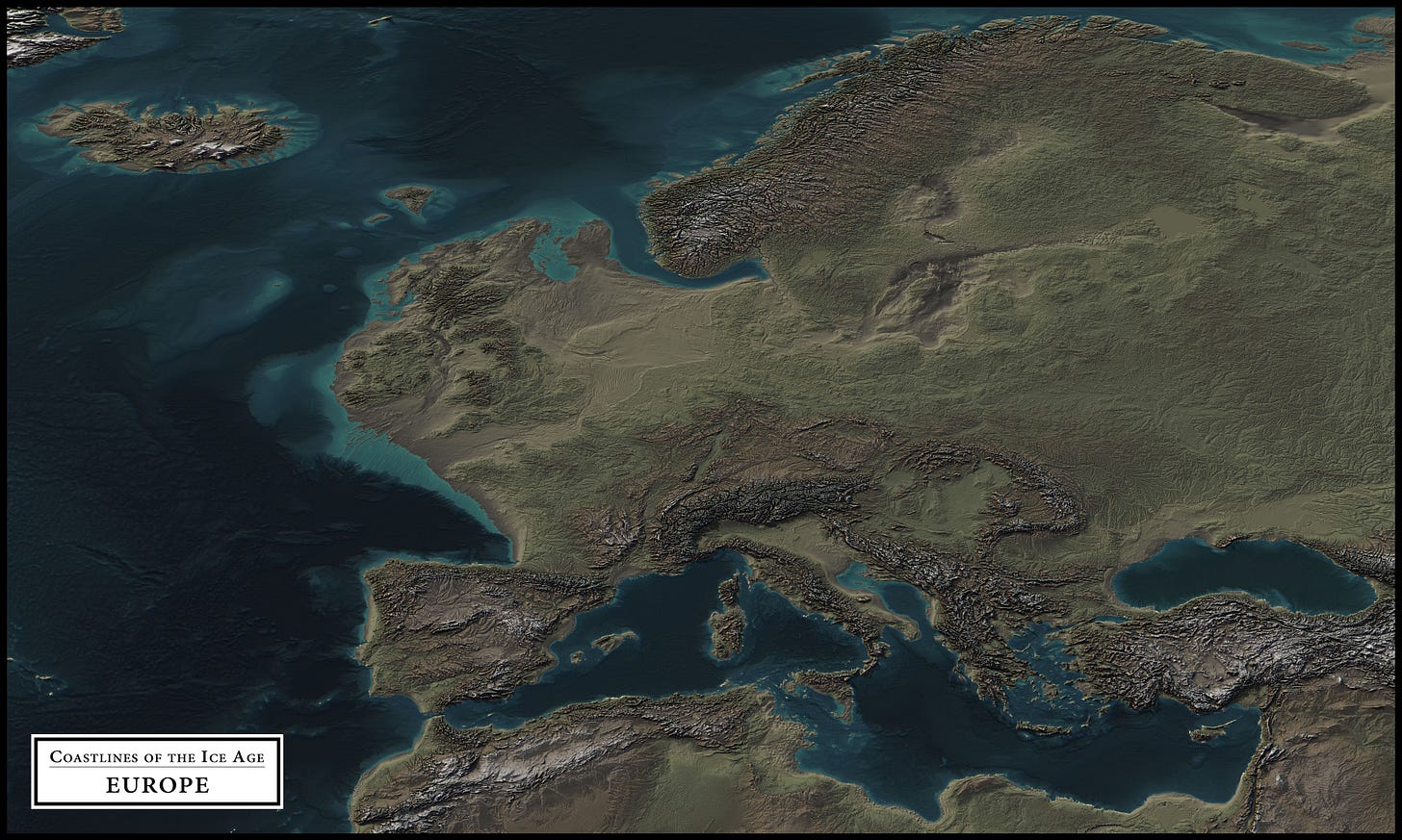
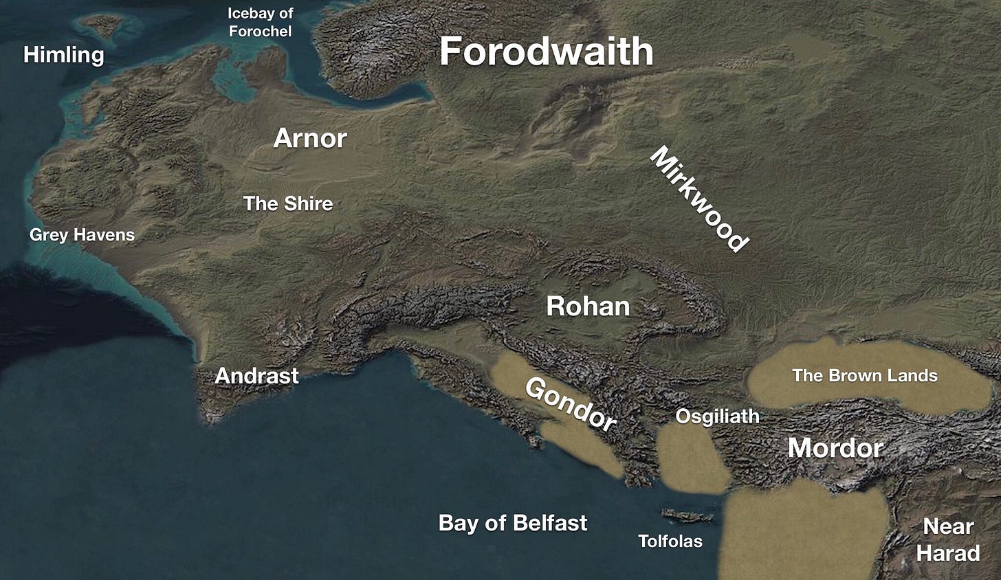
You probably noticed that the new map of Ice Age Europe/Middle-Earth at the top of this article looks different than the one I presented in the first entry. It’s been edited. The original map from the first post was an untampered map of Ice Age Europe that I used to show the similarity to Middle-Earth, but there were obvious issues in the Mediterranean region.
Most notably, what happened to Spain and Italy? This seemed to be another hole in my theory.
After further thought, I think the answer is actually pretty simple.
I think Professor Tolkien simply wanted to keep it a secret how seriously he took the idea that he was writing a true mythology. (Apologies for writing this, Professor). Perhaps it was for academic reasons, as I assume he would not want to be labeled as some crackpot.
For him to be able to keep the notion of his stories being a true mythology of Europe in the background, he couldn’t make things too obvious.
Few things are as obvious as the coastline of the Mediterranean.
Tolkien simplified this region in his map because the shoreline of the Mediterranean is so recognizable that a child could see it. He could not realistically depict it without giving away what he was doing.
He used the real shorelines of ancient Northwestern Europe, because they would not be recognizable (well, until now).
He erased identifiable peninsulas like Iberia and Southern Italy. He erased the large, identifiable Mediterranean islands. He merged Greece and Italy into one solid landmass, disguising their recognizable shapes.
Then he added more land underneath Turkey/Mordor, which keeps it from looking like the iconic land-bridge country.
The large island of Crete remains, matching Middle-Earth’s Tolfolas. And of course, he simply does not depict the shoreline of North Africa, leaving it out of frame.
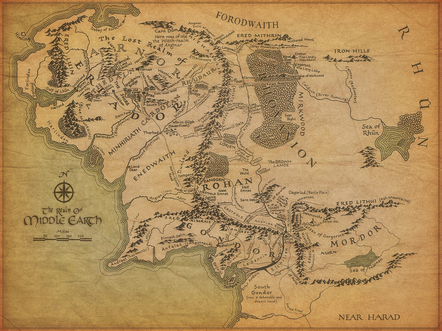
With just these few changes, Ice-Age Europe becomes Middle-Earth, plain as day. Everything else on the real map remains the same. Here’s the map progression:
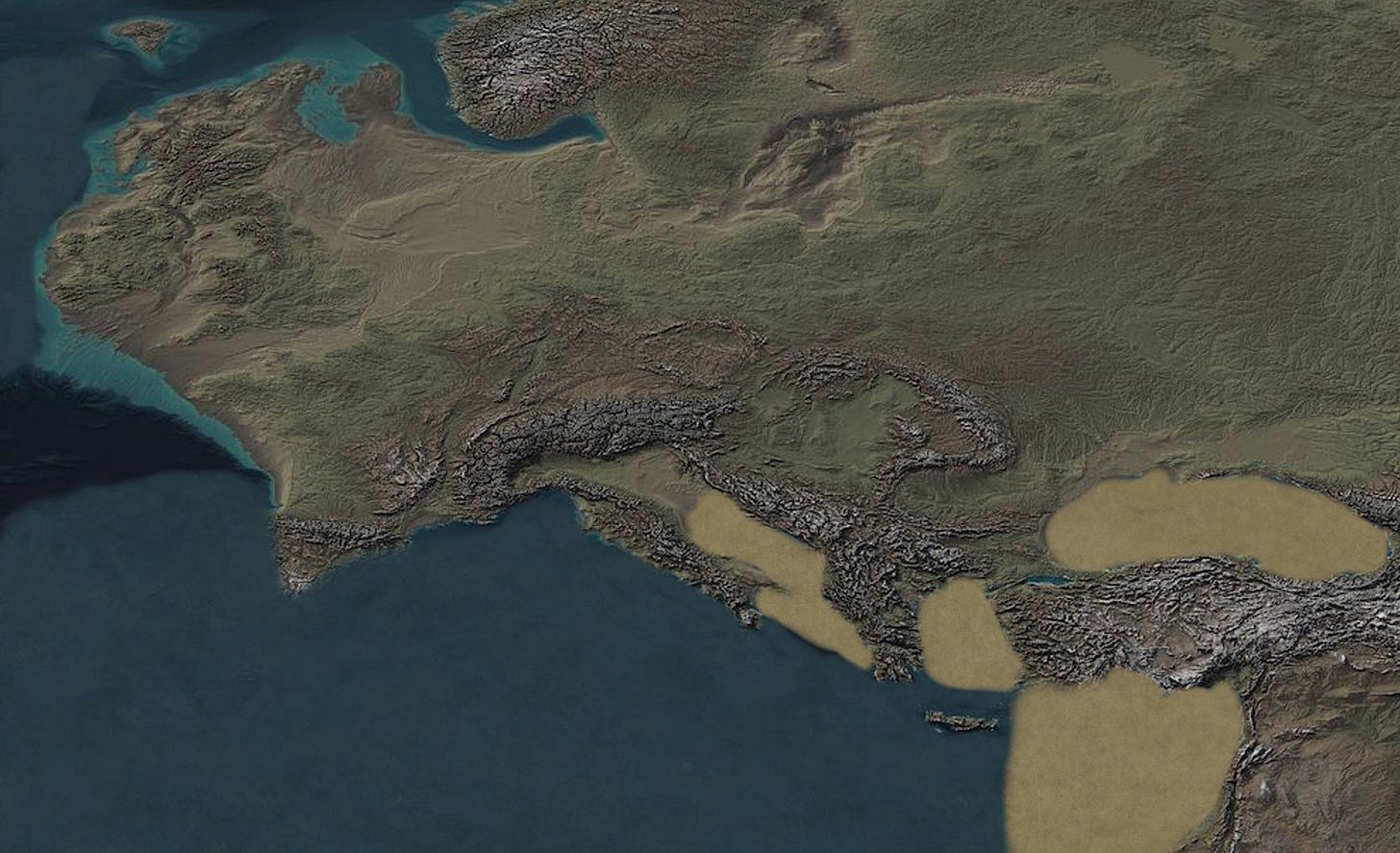
With only these changes, the Ice-Age map becomes almost indistinguishable from Middle-Earth.
Concluding
The question still remains as to why Tolkien kept all this so close to the chest, as well as how he seems to have known things about the landscape of ancient Europe that were not common knowledge during his time.
I have heard rumors of special documents and manuscripts detailing ancient histories that Tolkien supposedly had access to at Oxford, but I have not been able to learn enough about this to write on it yet. Perhaps that will be a future installment.
But whatever the answer to these questions is, I am confident that we can no longer pretend that Tolkien was only writing fiction, or that his claim that his mythology was our own ancient history was only a fanciful notion or frame story for him.
Unfortunately, we cannot ask the Professor now.
But I am confident in saying that the reason his legends of Middle-Earth are so beloved, the reason they have become such an integral part of Anglo-sphere culture, the reason that they have started to become as much a part of the Northwestern European mythos as the “real” mythologies like the Eddas or the Norse Sagas or Beowulf or Arthurian legend… is because it is a real mythology itself.
God Bless.









Professor Tolkien used his blood memory and revelations in his dreams, besides being blessed with deep understanding of mythology and culture. So unreal it's real. Great read, as always.
I like this. A lot.
According to Wikipedia, Tolkien would certainly have had access to information about Doggerland. H.G. Wells wrote about it as early as 1897. https://www.gutenberg.org/files/27365/27365-h/27365-h.htm#Page_59
Indeed, there seems to have been significant interest in this area of now-submerged Europe in the first few decades of the twentieth century. Someone as well-read as Tolkien must, I think be assumed to have been aware of it.
As to why Tolkien kept such associations/origins to himself. . . I think the answer is probably a lot more straightforward and, unfortunately, less interesting than some that have been suggested both here and in your previous post. Tolkien may have been one of (if not the) first authors to come up with a detailed fictional map of a fantasy world, but he would hardly be the last. I think Tolkien just straight-up borrowed/stole real geography of Iron Age Europe for the sake of convenience, just like Martin obviously repurposed the geography of the British Isles for his map of Westeros. I mean, seriously: https://brilliantmaps.com/westeros/
Why did he keep this to himself? Because I think convenience was likely the main motivation. If he had really intended for the geographic connections to convey real meaning, I don't see any reason he couldn't or wouldn't have just said so. He certainly wasn't coy about his works' meaning in other contexts. So the fact that he never really did much with this suggests, to me, that he didn't want his works to be burdened with the "Gondor is Rome, Mordor is Persia/the Ottomans" associations that would have inevitably arisen if he'd been clearer about that.
It's worth mentioning at this point that Tolkien does reference Rome (Rûm), Troy (Trui), Babylon (Bablon), and Nineveh (Ninwi) in very early versions of his legendarium. But these are all depicted as having met their ends long after the end of the Third Age.